![]()


But I Could Hit a Hill...
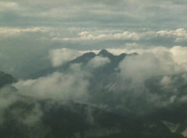
GPS direct? Check terrain clearance.
Almost from the day that Doug McCurdy lifted the Silver Dart off the frozen surface of Bras d'Or Lake, pilots have sought a reliable way to stay on track while traversing the vast wilderness that makes up so much of Canada.
In the bad old days, they used maps. Often, the maps were inaccurate. But as time wore on, the maps got better. In many areas of the country, that wasn't much help. One little lake looked much like another. So did the valleys and what-not. On a clear day, it didn't matter too much. Pilots could see for miles, and generally stayed somewhere near the intended track.
Some of the time, it wasn't clear. Oh, there was generally enough visibility to remain in visual meteorological conditions (VMC) in visual flight rules (VFR) flight if one was flexible about how one interpreted one or two miles, but map-reading became much more difficult under those conditions.
Over the years, maps and NAVAIDs improved. Still, for most pilots, the only time they were on track was when they unknowingly crossed it. As a result, many aviators spent considerable time being momentarily unaware of their position. For some, that moment stretched to eternity.
To get around such unhappy accidents, many incredibly talented people developed a navigation system so accurate that it could be and is used in some cities to deliver pizzas to specific residences. Aviators soon found that this system, known as the Global Positioning System (GPS), could be used to supplement the map-reading skills that were the bedrock of their VFR navigation over remote terrain. As a result, pilots flocked to buy GPS receivers that would keep them right on track.
As more and more pilots began using GPS, they started developing a great degree of confidence that it would always lead them to their destination. Confidence is one thing, over confidence another. We've had a lot of reports that pilots with GPS sets are setting out on VFR flights that they would have cancelled in the past because the weather was marginal or because it was dark. This attitude has a lot of accident potential. First of all, GPS is not infallible. As we've said many times in the past, GPS satellites can transmit faulty signals and, unless you have an installation certified for instrument flight rules (IFR) flight, you won't be warned. Faulty satellites have caused 80-mi. position errors in the past. Even if you have an IFR box, there will be times when there just won't be enough satellites to navigate. What if this happens at a critical point in your flight when the visibility is too poor to map-read?
Even if there are lots of satellites and they're all working properly, all that GPS can do is take you to the waypoints you've programmed into the box. What if you've entered the wrong coordinates? Even experienced airline crews flying 747s have made this mistake, so what makes you immune? If you can't see the ground well enough to confirm you're on track, how will you know if your mistake is leading you into the side of a hill?
On the subject of controlled flight into terrain (CFIT), let's suppose that GPS is working flawlessly and you've entered the correct waypoints. You'd still better have plotted your track on a map and checked for obstacles. Not just along the track, but to either side as well, and don't forget to look for obstacles below the altitude you intend to fly.
If the weather is already bad, it could get worse, and you might have to descend or deviate. The course you've plotted may not give you these options, and so now you're betting your life on the weather not changing. Does this sound like a good idea to you? Suppose you can deviate and find some better conditions. Now you'll likely use the "direct-to" feature on the box to continue to destination. You'd better have another look at the map at this point. Plot your new track to destination and follow all the advice we've given above.
For years, pilots wanted a navigation system to keep them precisely on track all the time. Now that we have it, some are replacing the risk of getting lost with the risk of flying into an obstacle. VFR navigation means being able to see the ground well enough to navigate safely.
There's no category between VFR and IFR. Make a choice, and follow the common-sense rules that go with your choice!
Originally Published: ASL 3/1997
Original Article: But I Could Hit a Hill...
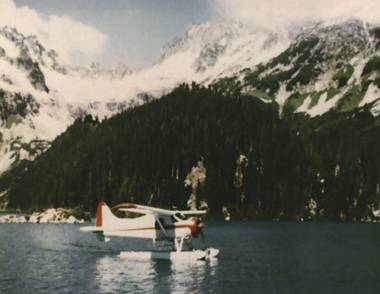
Into the Snow and Rain — Controlled Flight Into Terrain
Put yourself in this position:
You're a very experienced pilot, with a very experienced co-pilot along for the ride. However, neither you nor your co-pilot has much mountain-flying experience. Your aircraft has just been completely rebuilt and is fresh off a successful test flight. You've had an extensive weather briefing, and the forecast is "good VFR" with occasional reduced visibility in snow. The FSS specialist recommends the Skeena Valley VFR route because of lower altitude requirements should you run into adverse weather, but you have a pilot report (only 2.5 h old) from the Telkwa Pass, indicating a 3500-ft. ceiling, with visibility occasionally down to 10 mi. in light snow. You select the Telkwa Pass because its so much shorter.
You're now penetrating the British Columbia coastal mountains from Terrace to Smithers, flying toward the Telkwa Pass through occasional snow showers. Thirty miles cumulus, virga and rain in all quadrants. Do you continue? If you do, are you spring-loaded to perform a 180· turn in a very tight mountain pass?
One 10,000-h pilot continued, and wasnt prepared.
The wreckage was located in an avalanche area at the bottom of a recent slide. The engine was at the 7000-ft. level, and parts had slid down more than 3000 ft. Neither pilot had survived. Because of the treacherous area, a detailed investigation could not be completed. However, it is more than likely that the pilot turned a corner and flew into instrument conditions - and into the towering mountain.
Originally Published: ASL 3/1997
Original Article: Into the Snow and Rain - Controlled Flight Into Terrain
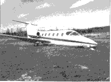
Stacking the Odds in the Mountains
The MU 300 Diamond touched down in the first thousand feet of the bare and dry 4500 ft. Jasper Hinton runway. The captain applied maximum braking, but he quickly realized that he would not be able to stop on the runway remaining. He initiated a series of "S" turns, believing that, by increasing the distance travelled, he would improve his chances of stopping before running off the pavement. He could not.
The aircraft skidded to a stop 225 ft. off the end, with the left main and nose gears collapsed. Numerous wrinkles in the fuselage skin and structure indicated serious airframe damage. Jet fuel leaked into the ground from the ruptured left wing tank (TSB Report A95W0034). Thankfully, fire did not break out, and the four on board walked away uninjured.
Both pilots had flown into Jasper Hinton before. So how did this experienced crew stack the odds so high against a successful landing?
At the pre-flight planning stage, the crew might have noted that there are no readily available weather observations for the Jasper Hinton aerodrome. (There are automated observations recorded at Jasper Hinton, stored and forwarded twice daily to Environment Canada. Human observations have since ceased at Jasper, also replaced by an autostation. Neither of these autostations meet aviation standards. There is an Automated Weather Observation System (AWOS) in Edson, 45 mi. east of Jasper Hinton. Since 1991, these observations have been available on normal weather information circuits and were available to ATS. They are not available by local voice generator module.)
At the time, the nearest official weather observations were taken at the Jasper townsite, 7 NM from the Jasper airstrip, and 30 NM from the Jasper Hinton aerodrome and separated from it by 8000 ft. mountains. When the FSS briefer gave them the "Jasper" weather, the crew members assumed that they were getting Jasper Hinton information and the specialist was merely abbreviating the name. They made the same assumption later when the Edmonton Centre controller passed them the latest "Jasper" weather before clearing them for descent. The regulations require ATS to give pilots the nearest official weather and altimeter setting.
Potential name confusion is not unique to these two aerodromes. There are numerous opportunities across Canada to duplicate the mistake: Moose Jaw/Moose Jaw Muni; Edmonton Intl/Edmonton Muni; Cold Lake/Cold Lake Regional; Gods Lake/Gods Lake Narrows; and La Grande 3/La Grande 4, just to name a few. So if you are aiming for Gods Lake and are told that "Gods Lake Weather is...," beware: Gods Lake does not report weather. Gods Lake Narrows does, but it's 30 NM to the west of your destination.
While the weather was basically clear at both sites, the winds at Jasper were calm, while the winds at Jasper Hinton, on the other side of the mountain range, were out of the southwest at 14 kt., gusting to 21 kt.
Subsidence of the air coming out of the mountains and the funnelling effect of the valley to the west of the airport both mean that the Jasper Hinton winds are generally stronger. Because of the unpredictable variable winds, Jasper Hinton has three windsocks serving the one runway: one at each end, and a lighted sock at centre field.
It is not unusual for winds and weather in the mountains to vary widely over short distances.
Previous experience (both pilots had been there before) and a pre departure review of aerodrome information should have reminded the crew that, except for the first 400 ft., Runway 02 has a distinct downslope.
Arriving at Jasper Hinton, the crew did not follow the procedures recommended for uncontrolled aerodromes. Those procedures suggest that a pilot should overfly the aerodrome prior to landing to determine wind and verify that the runway is unobstructed.
Believing that the winds were calm, and with 25 mi. visibility, the pilots did not feel that a visual inspection was needed. They proceeded with a straight in approach for landing on Runway 02.
On approach, the captain decided to add 10 kt. to the reference speed (Vref) to compensate for subsiding air, turbulence and airspeed fluctuations. (All of these factors should have alerted the crew to strong winds. Observing smoke, trees and water during their descent would also have warned them of the wind's strength and direction.)
On short final, the crew observed the windsock extended parallel to the ground and varying in direction. What they failed to take in was that it was not varying off the nose, but straight up the tailpipe.
So here's how the odds stacked up:
- inadequate preflight planning;
- winds and weather for a site 30 mi. away, on the other side of a high mountain ridge;
- a lack of appreciation of mountain weather;
- unclear preflight briefing and en route radio communications;
- disregard for recommended practices;
- failure to use the clues the strong winds were giving;
- observation of, but failure to see, the windsock; and
- a landing downwind, downslope, at 10 kt. above Vref.
A last second rejected landing might have saved the day, but, with those odds, the result was almost a sure bet.
Originally Published: 2/1997
Original Article: Stacking the Odds in the Mountains


Pilot Resources
Ask ATS
Weather
TSB
Interactive Materials
NOTAMs
Air Safety Institute
ELTs
Aviation Safety Letter
SmartPilot proudly works with.


We would like to acknowledge the financial support of the Government of Canada for this initiative through the Search and Rescue New Initiative Fund (SAR NIF).